Getting lost in America is still possible! With the number of people on the planet all sharing the same breathing room it seems a glorious luxury to have miles of wild all to ourselves. The fact that there is so much wild to get lost in, is in itself nothing short of a miracle. We walked into the Gila National Forest on it's western boundary and walked east through it for 11 days. Each one of those days extended exponentially by the adventure contained within them. We entered the Gila through the "Catwalk", a recreational trail built over an old pipeline once used for mining. The trail is basically metal scaffold bolted into sheer cliff walls over a rushing and turbulent Whitewater Creek. After leaving the recreation area we continued up the canyon and entered the Gila Wilderness, the first designated wilderness area in the nation. We would not see another person for 4 days. We would rarely have dry shoes in that time. We forded Whitewater Creek 38 times. Our journey continued up beyond the headwaters and on up to our high point of this journey. As we gained elevation we were concerned about snow and our route provided three bailout options if conditions warranted. After passing the first two we were feeling confident in our forward progress. At the final bailout point we ran into solid snow with the trail disappearing under it. The snow was deep enough that normal indicators of trail such as sawed, downed trees or any semblance of a trail corridor were completely invisible. To detour meant adding 26 miles and 2 extra days of travel. We did not plan for that with our food supplies. Luckily Christian is a navigational savant. I cannot overstate his route finding skills, the man is brilliant! I followed his snowy footprints in what felt like repeating circles. This continued for 5 miles while Christian kept consulting the map. Confirmations appeared in the top of a buried trail sign or a glimpse of our mountain top goal. We hiked until the sun set to take advantage of soft snow. The next day 20 yards of icy steep slopes kept us from hiking until 2:00 pm. When we finally could cross, it was up a snow ribbon to top out at 10,770 feet of Mogollon Baldy. It was gratifying to look back and see the country we had traveled to bring us not only to our highest point of the trip but also our half way point. It was also daunting to look ahead and see what remained.
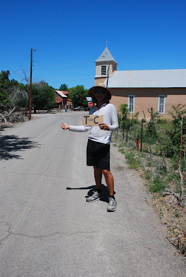
It was downhill from Mogollon Baldy to the West Fork of the Gila River. We would cross it 50 times over 16 miles before arriving at the end of the wilderness at the Gila Cliff Dwellings National Monument. After a quick resupply in Gila Hot Springs we were back in the forest. We spent some time at a hot spring and then left people behind for 5 more days as the entered the Aldo Leopold Wilderness. We forded both the East Fork and the Middle Fork of the Gila River. We shared the Continental Divide Trail for 40 miles as our route turned north and we crossed from the Gila Watershed into the Rio Grande Watershed. We saw elk, deer, javelina, turkey and antelope. After hiking into the Monticello Box and through some of the largest cottonwoods we have ever seen, we learned that our resupply stop of Monticello had no amenities. We were craving luxuries in the form of showers, TV, pizza and beer so we hitchhiked into "Truth or Consequences". While channel surfing we watched a show on Sahara Bushmen who routinely travel 40-50 miles a day in 120 degree temps with no navigational landmarks. Hmmm, kind of puts our ramblings into perspective.
Now we find ourselves ramping up for our final 250 miles and cannot imagine what adventures await us. We'll keep you posted.
Sunday, May 23, 2010
Monday, May 10, 2010
New Mexico - G.E.T.
Yippee, we crossed into New Mexico! We are just about half way through our journey and one month completed. We will be heading off into the Gila Wilderness, an area we have both greatly anticipated. It will be a refreshing change from the cow filled range land that we have been walking through in this land of Wranglers, boots and cowboys. On May 2nd we celebrated our 14 year anniversary. We celebrate the day we first met on the Pacific Crest Trail, so it's seems fitting to be out on a trail again. Our resupply towns only get smaller from here so updates may be slow in coming but we will do our best.
Tuesday, May 4, 2010
The Wild West - G.E.T. Style
It's rugged out here folks! The highlights and rewards come at a price, but when they reveal themselves we have found them to be commensurate with the struggles. In this section we hiked the "Safford-Morenci Trail" an historic trade route linking these two communities. What an amazing place! We hiked through gorgeous slot canyons, slept in a meadow with stately sycamores and marveled at the abundant bird life including the distinct warble of wild turkeys. The cliffs above us housed prehistoric granaries. From there it was on to more slot canyons in Midnight Canyon. It was stunning and neither of us could believe we had never heard of it before. We have felt so isolated on this trip so it was a bit of a shock to run into 3 girls from Tucson hiking west on our chosen route. They raved about the upcoming Eagle Creek section. I'm embarrassed to admit we had considered a shorter route but quickly got our priorities in line and headed for the perennial creek. Eagle Creek is owned by Phelps-Dodge who also owns the Morenci Copper Mine. Cattle and vehicle activity are permitted but if not for that this area would rival the Aravaipa Wilderness. Dramatic cliffs lined the way as we forded the creek 50 or more times. From Eagle Creek we hiked the Primitive Bluff Trail. It's remote and yet evidence of those that came before was ours with some effort. We did an uphill, cross-country climb to some well preserved Anasazi rock art. Once again our efforts rewarded us. Our next views were dramatic in a different, more modern way. The Morenci Mine is one of the largest open pit mines in the world and is North America's largest producer of copper cathode and our resupply location. Our first hitchhike of this trip had us anxious about securing a ride. Highway 191 is a lonely, winding road. The shadows grew long as we waited 2 hours for a generous driver to stop for us. While this company town has almost everything we need, the library computers will not allow us to upload photos. Hopefully we can in our next town which lies over the border in New Mexico!
Subscribe to:
Posts (Atom)


